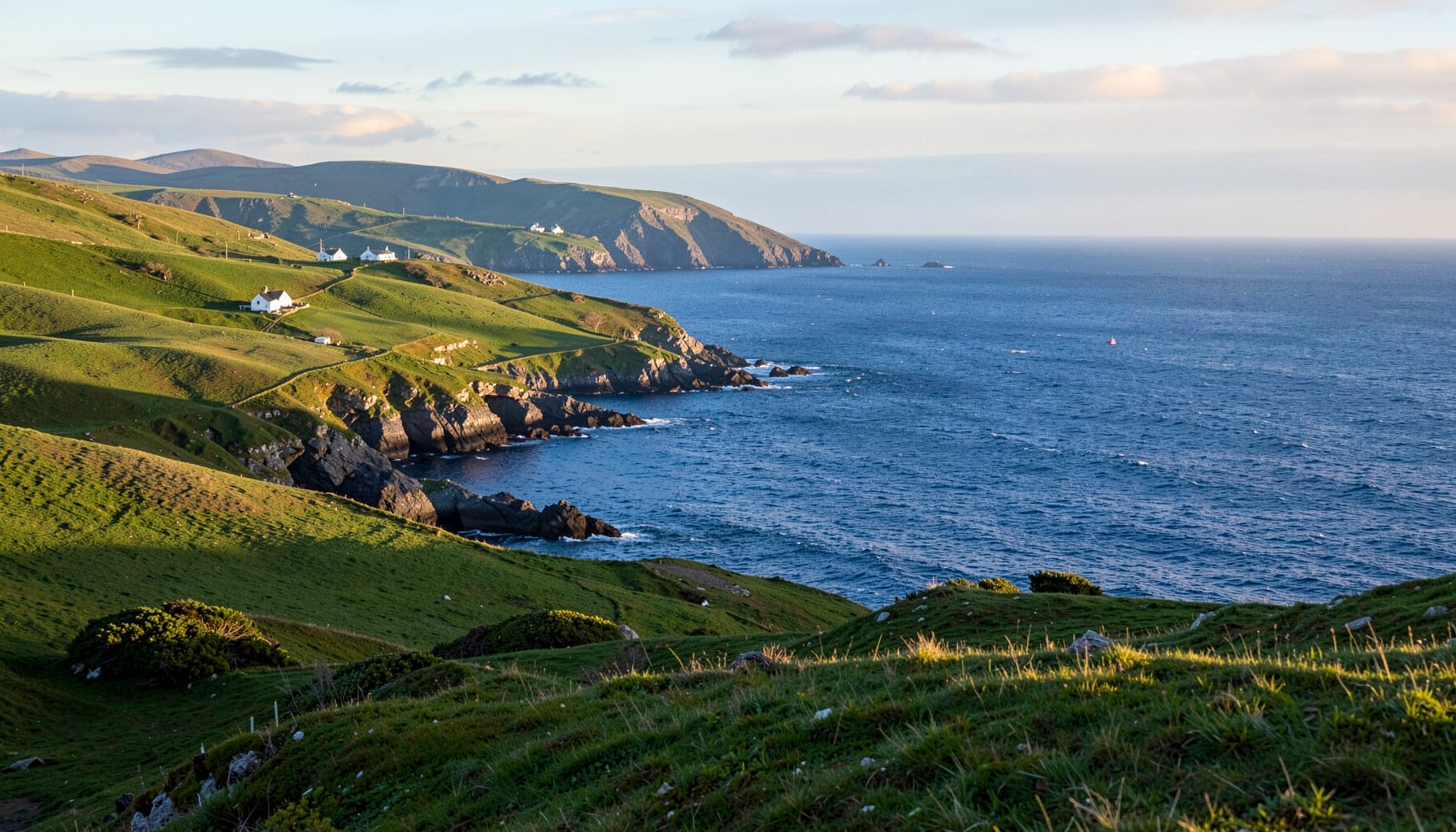
The best hidden coves and secluded beaches accessible only by foot
The Skellig Coast on Ireland’s Iveragh Peninsula rewards walkers with sudden gaps of sand, rock and open Atlantic between Kells and Castlecove. Away from busier strands, the final approach often follows a lane, crosses farmland or traverses exposed rock. Quiet coves have no car park at the shoreline, no kiosk and usually only footsteps, birds and wind.
These places are not unknown. Fishermen, farmers and local walkers know them, and some support grazing, swimming or shelter. Seclusion is seasonal, shaped by tides, swell and access rights. A bay broad at low water can become a steep channel at high water, while an easy crossing can disappear. Leave time to turn back.
Most walks begin in a village or public car park and use a recognised path for the final stretch. A foot-only beach is not necessarily a remote day hike: Bray Head lanes and the Kerry Way can reach secluded shore within an hour or two. The final surface may be wet rock, uneven grass or loose scree.
Australians from Sydney or Melbourne know beaches and harbour paths as familiar weekend territory. Irish conditions still require preparation for wind, rain and fast-changing Atlantic weather. Think in kilometres rather than miles, pack for a cool horizon and remember that a scenic route may cross active farmland. Courtesy begins with closed gates and undisturbed livestock.
Reading the coast before setting off
Here, accessible only by foot describes the final approach, not the whole outing. You may park in Portmagee, Sneem, Waterville or Castlecove, then follow a public footpath, farm track or cliff path for the last kilometre. Access rights differ: check signs, control dogs and never assume an unmarked route across private ground is permitted.
Build the walk around the tide, not just the weather. Low tide reveals rock shelves and sandbars, but platforms can be slick and undercut by swell. High tide narrows the shore and removes safe space. Suitable footwear, a charged phone and bad-weather cover matter more than extra gear. Check official tide tables and turn back before water reaches the path.
Bray Head and the Portmagee coves
Bray Head offers the clearest introduction to foot-only shore access. Its loop climbs from the Portmagee side, crosses open headland and returns through lanes. Keem Bay is easy by car, but the smaller rock-backed coves beyond the road fit the secluded brief. Continue on authorised paths towards the Faha lanes, pausing only where a separate public footpath reaches the shore.
These coves reward low tide and close inspection. Rock ribs shelter strips of sand, while ledges form brief pools. The return climb is exposed, so turn back before fatigue makes the final scramble seem longer. In wet weather, spray can reach far inland and the apparent shelter of a cove can vanish when the wind turns.
Cahersiveen makes a good rest stop, with village streets, a market and a warming meal. Local history adds another layer: the O'Shea family distillery shows how this Atlantic town became linked with produce, trade and craft. It also reminds visitors that the Skellig Coast is a working landscape, not simply a scenic trail.
Kerry Way bays above Castlemaine Harbour
Northern Kerry Way paths around Castlemaine Harbour, Aghagower, Kells and Glenbeigh combine lanes, open country and short descents. Rossnowlagh and Castlemaine Strand have road access, so they do not meet the secluded brief. Smaller shore-side pockets are quieter, but walkers should watch for traffic, cattle grids and unclear junctions.
Public rights can be uneven. A beach may look open from a hill while the direct line crosses private land or a working farm. Use known rights of way, avoid gate hopping and respect livestock, walls and farm traffic. Tides can open a sand route at one stage and close it later.
| Walk | Best feature | Final approach | Main caution |
|---|---|---|---|
| Bray Head coves | Rock pools and cliff-backed sand | Footpaths from Portmagee lanes | Steep and exposed |
| Northern Kerry Way | Sheltered sand and shingle pockets | Marked lanes near Castlemaine Harbour | Road crossings and livestock |
| Waterville shore | Coves below wooded slopes | Village and harbour paths | Slippery rock and seaweed |
| Sneem waterside | Quiet inlets and river-mouth beaches | Waterfront and woodland paths | Muddy estuary edges |
| Castlecove coast | Long, open shoreline views | Longer walks from village centres | Few facilities offshore |
These routes vary more by landscape than distance. Bray Head is compact but steep; the Kerry Way favours longer country days; Waterville and Sneem mix shore and woodland; Castlecove suits walkers comfortable with remoteness. Match the route to your footwear, tide confidence and preferred length.
Waterville, Sneem and wooded shore paths
Waterville differs from the exposed western headlands. Paths around the harbour and towards Ardmore reveal coves where mountain slopes meet a narrow strand. The scenery feels enclosed, yet the water faces the same Atlantic weather. Use public access points around the harbour rather than following private drives towards apparently quieter water.
Sneem’s harbour and wooded river mouth create sheltered-looking corners. Some are rocky inlets rather than sandy beaches, with branches, tidal mud and dark water providing enclosure. Local paths link the waterfront to higher ground, where the Dingle Peninsula feels closer and the wind can be strong. These intimate spaces offer little shelter when weather turns.
Another island shaped by geology is the fire-born island, which introduces Camiguin’s lava, hot springs and tropical growth. Its climate differs greatly from Kerry’s layered sandstone, peat-dark inlets and cool swell. Both reward walkers who look below the headline view and read the smaller signs of rock, water and vegetation around each bay.
Castlecove, Kells and tidal island walks
Castlecove and nearby Derrymore Lough provide long coastal lines rather than tiny urban beaches. Public paths around the lough and shoreline reach sand and shallow-water areas where birds gather, while harder walking leads to distant coves. Facilities are scattered, so carry water and treat settlements as possible last stops rather than planning a late shore drink.
The Kells side offers strong isolation. Routes across the northern Kerry Way landscape combine farm tracks with high viewpoints over ridges and bays. On clear days, islands sit offshore like dark punctuation; in rough weather, visibility may close sharply. These are routes for steady navigators, not shortcuts between car parks, and exposed sections deserve respect.
Great Samphire and Little Samphire offer another secluded shore. On a calm, officially suitable tide, their causeways may be walked, exposing beaches and rock gardens that vanish beneath the sea for much of the cycle. Official tide information is essential. A causeway never guarantees safe swimming because currents and depth change quickly. Leave before the returning tide approaches and obey local closures.
Australian habits meet Irish coastal rules
Australians from Sydney, Melbourne, Adelaide or Hobart know that an ocean walk can be a routine weekend habit. That familiarity helps with pacing, layers and shared-path etiquette, but can create false confidence. An Irish track may be shorter yet wetter, steeper and more exposed, with no café, shade or phone signal around the next bend.
Australian outdoor habits still travel well. Trail runners, a reusable bottle, sunscreen and a thermos are useful, although an Irish sky changes the priorities. Keep waterproofs accessible and a warm layer in the daypack. Irish emergency numbers are 112 or 999, while Australia uses 000; save both before departure. Share your route before entering a remote stretch.
Both countries drive on the left, although Kerry’s lanes can be narrower than roads around Melbourne or Perth. Park once and walk rather than hunting for shoreline parking. Market habits offer another connection: shoppers used to growers’ markets, regional delis or Melbourne’s Queen Victoria Market will find Cahersiveen’s smaller market friendly, with local cheese, bread and preserves.
Public-land legislation differs. Australian reserve rules vary by state and council; Ireland applies national and local rules, including byelaws concerning dogs, gates, livestock, fires and protected habitats. Follow Kerry County Council and park signs rather than assuming Australian rules carry over. Drones, campfires and off-path riding may be restricted in open country. Local permission or a short detour protects both walker and landscape.
Leave the coves quieter than you found them
The finest coves have little infrastructure, so preserve that quality. Stay on durable surfaces, take rubbish back, avoid building cairns and leave shells and plants. Keep dogs controlled near sheep, nesting seabirds and blind corners. If a beach becomes crowded, continue on the authorised path rather than cutting through dunes or heather.
Safety and respect reinforce each other. Tell someone your route, carry a charged phone, check tide and wind, and turn back from wet cliff edges. Small communities depend on fields, lanes and car parks remaining usable. Do not block gateways, park on verges without permission or leave litter at the trailhead. Support licensed local producers rather than unlicensed sellers.
Choose one foot-access route, confirm the tide and official access notices, and set a pace that leaves the shore unhurried. Bring water, respect every gate and enjoy these small, wild places reached slowly on foot. The reward is a shoreline belonging more to the weather and landscape than to cars.