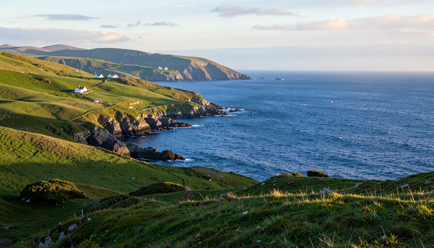
Coastguard Lookouts and Wartime Defences of the Skellig Coast
The Atlantic edge of the Iveragh Peninsula can appear unchanged by time. Sheep tracks still cross steep ground above the sea, stone ruins cling to exposed slopes, and the horizon lies open between Kells and Castlecove. Yet those quiet places contain a layered human history, especially the story of the coastguard lookout posts and the wartime watchers who kept watch along this demanding shore.
A lookout was rarely a grand fortification. It could be a shelter beside a headland, a signal station overlooking a busy passage, or a temporary observation post occupied by local volunteers. From such places, people scanned for vessels, passed warnings, recorded weather and sometimes helped those in distress at sea. Their work connected local knowledge with an expanding system of maritime defence.
That history is best understood through the landscape. Older signal towers and lighthouse sites show where nineteenth-century navigation mattered most; wartime positions reveal the fears and procedures of the 1940s. Ordinary buildings, tracks and family recollections often preserve the rest of the story, linking defence, fishing, farming and rescue rather than separating them into separate histories.
Australian readers may recognise the familiar work of keeping watch over a coastline, from Sydney Harbour to the working waterfronts of Melbourne and Fremantle. The Skellig Coast version belongs to a distinct Irish setting, but the underlying questions are shared: who is watching, how warnings travel, and what communities do when weather and geopolitics bring danger close to home.
From revenue patrols to a civilian service
Early nineteenth-century coastguard activity in Ireland grew out of the need to prevent smuggling and protect revenue. The service was established in 1822 and, during much of the 1830s and 1840s, operated under Royal Navy administration. An Irish civilian organisation followed in 1863, creating a settled framework for stations, uniforms, reporting duties and links with local communities.
The duties changed as the service evolved. Revenue patrols and harbour security remained important, but lookouts also became part of a wider safety network. Their observations helped identify vessels, while shore-based personnel handled situations requiring a boat, medical help or an official message. A remote post could therefore hold an essential piece of information.
Communication shaped every posting. Written logs, coded flags, lamps, telephones and, later, radio allowed warnings to move from one observer to the next. Some sites stood deliberately high, offering long views across shipping lanes; others guarded narrow channels or sheltered landing places. The best-known landmarks represent only the most visible part of a network dependent on careful timing and disciplined handovers.
Lookouts on headlands, bays and island approaches
Geography determined this network. Heights around Bray Head and the lower slopes of Mount Brandon offered broad views towards the Atlantic and Portmagee Channel, while points near harbour entrances allowed closer observation of local traffic. Wartime observers sometimes reused older signal sites, but also occupied farm buildings, quarry shelters and temporary huts on exposed land.
Bray Head signal tower on Valentia Island, begun in the 1840s, recalls an era when visibility and calculation had to replace modern navigation aids. Valentia lighthouse added another landmark, while Skellig Michael lighthouse, first lit in 1854, assisted vessels near hazardous rocks. These structures served commerce and safety as well as national authority, even when their military value later increased.
Most everyday posts were far less substantial. A low stone wall, rectangular shelter, patch of flattened ground or name on an old map may mark what remains. Local residents knew which paths remained passable in rain and where squalls could trap walkers. Their practical intelligence was indispensable to watchkeepers, and it often appears more vividly in oral history than in a formal record.
The island's later fame as a Star Wars filming location has brought new visitors to Skellig Michael, but the cinematic landscape rests on older realities: navigation, isolation, weather and resilience. The coastguard and wartime layers belong to that foundation, alongside fishing and pilgrimage, rather than forming a separate story added after the films.
Wartime watchfulness on a neutral coast
Éire declared neutrality in 1939 and remained outside the Second World War. Nevertheless, neutral coasts were not passive ones. The Local Defence Force, civil defence volunteers and other authorised observers established watch duties, maintained communication points and monitored activity that might affect Irish sovereignty. For communities already accustomed to coastal reporting, wartime service added urgency to familiar routines.
Tasks included watching for submarines, suspicious vessels and unfamiliar aircraft, then recording and passing observations. Posts were manned in shifts and connected by field telephones or messages carried on foot. Darkness, cloud and uncertain reports made accuracy crucial. A coastwatcher needed to distinguish ordinary fishing traffic from anything unusual, often using local knowledge and instruments that were simple by later standards.
Defence measures could include shore batteries, searchlights and anti-aircraft positions, yet local memories often concentrate on quieter forms of service: repairing wires, maintaining fires, distributing instructions, waiting through wet nights and supporting families. The 1942 landing of a German submarine at Fenagh in County Kerry showed how an emergency could overtake an ordinary landscape and demand rapid action.
Changing technology and enduring duties
Radio, radar, motorboats and improved communications transformed the coastguard lookout post. Electronic sensors and vessel-tracking systems now provide information that an observer once gathered by eye, while modern rescue coordination depends on skilled teamwork rather than a single lamp signal. Some historic sites became obsolete; others survived as paths, viewpoints, training locations or reminders of a working maritime culture.
The language of service has broadened accordingly. Alongside preventing smuggling and protecting revenue, today's responsibilities include supporting search and rescue, responding to pollution incidents, promoting safety around busy waters and checking maritime infrastructure. Volunteer rescue organisations and lifeboat crews continue a practical tradition in which people trained for emergencies remain ready on the shoreline.
Historic posts still teach useful lessons. They show how people communicated across difficult terrain, how authorities balanced national security with local life, and why weather can dictate the use of a harbour or island. Local museums, historical societies, walking groups and harbour users can reveal these connections through photographs, documents and the recollections of families who once lived beside these places.
Shared coastal traditions across Australia
For many Australians, coastal watchfulness feels familiar rather than exotic. The Australian Volunteer Coastal Patrol has its roots in Sydney in 1948, reflecting a public commitment to observe local waters and assist those in difficulty. Sydney Harbour's maritime identity also appears in community reunions, volunteer training and the everyday presence of working vessels alongside recreational traffic.
Melbourne offers another familiar parallel. Port Phillip Bay has a long volunteer lifeboat tradition, a pattern that illustrates how shoreline communities turn local knowledge into practical assistance. Its maritime history includes wartime observation, changing navigation practices and working ports whose rhythms remain closely tied to weather and tide.
Fremantle brings a different perspective, with harbour defences, lighthouses and a working port beside the Indian Ocean. At Fremantle Markets, visitors often combine local produce, handmade goods and coffee with a walk around the waterfront, joining everyday trade to maritime heritage. Australian communities also commonly acknowledge emergency volunteers through fundraising and service-club gatherings, a public recognition that finds its own expression in Kerry heritage walks, school projects and family memories of coastwatchers.
Safe exploration of exposed coastal sites
Historic lookout sites can be alluring but demanding. Cliff paths above the Atlantic may be wet, steep or exposed to sudden weather, and some structures stand on unstable ground or private property. Planning the route, checking conditions and understanding access restrictions help visitors appreciate fragile places without adding pressure to the communities that care for them.
- Check Met Éireann wind, rain and wave forecasts before setting out for exposed headlands.
- Keep clear of cliff edges, slippery surfaces and unstable ground around old ruins.
- Tell someone your route and expected return time, and carry a charged mobile phone.
- Use local guides for military sites, including permissions where photography is restricted.
Published Sohoton safety guidance offers a useful comparison for visitors to exposed natural sites in Samar. The landscape is different, but the principle is shared: learn about access, carry appropriate equipment and leave if conditions deteriorate, rather than treating an impressive viewpoint as an ordinary paved attraction.
Keep the coastwatching story active
Visit the coast with its watchfulness in view. A coastal walk can become a history walk when a former signal tower, wartime shelter or old harbour path is read alongside weather, shipping and local livelihoods. Public trails and heritage events provide an accessible entry point, while local guides can explain sites that do not appear clearly on a visitor map.
Support the people keeping this record alive by joining a community talk, sharing family photographs with a local history collection and using local services when visiting the region. The local learning hubs can connect visitors with interpretation and community activity. By noticing the small posts and the people who remember them, visitors become part of the coast's continuing story of watchfulness and care.